This post contains a few write ups of walking paths around the Bay Area, with a special emphasis on flat and well-maintained trails. Enjoy!
Right now, this is a work in progress, but I wanted to get the seed of the thing up. I’ll announce it more formally when I’m satisfied I’ve added enough paths.
Stanford Dish Trails
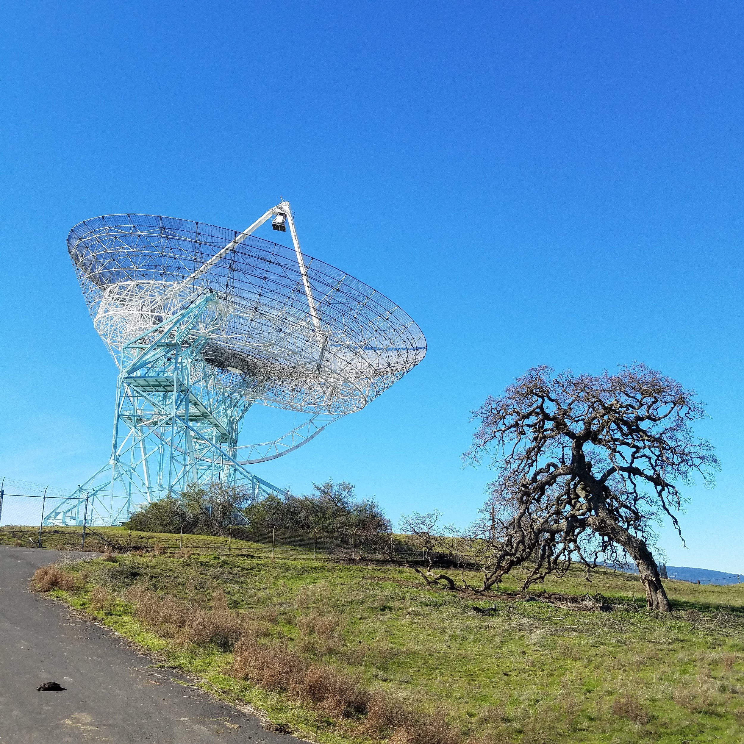
Privately owned open space at the western edge of Stanford’s Campus.
Max Elevation, at the Dish, is ~500 ft (above sea level).
The terrain is rolling hills with grass, live oak, and other drought-tolerant tree-stands.
The trails are mostly paved trails. The few non-paved trails are graveled.
Parking lot trailheads are at Stanford & Junipero Serra, and at Alpine Road. Parking Lot elevations are around 200 ft (asl).
Junipero Serra lot has direct access to “the loop trail” up to the dish and back down, up and down a few sets of hills. This trail has a variety of shelter and shade.
Alpine Road starts in a Eucalyptus grove by a creek, and brings you steadily uphill to the dish, across many open cow pastures, with very little shelter or shade after the Eucalyptus grove.
Pearson-Arastradero Preserve

A rolling set of shallow creek valleys, gradually giving way to the slope of the Coastal Range. From the parking lot on Arastradero Road, the first mile on any of the trails is flat. As you leave the concentrated watershed of the creek, the trails get steeper, the vegetation gets more scarce, and the difficulty increases.
This is a good place to do ever-growing loops, where you get a little bit further up the hill each day. As you climb the hill, the two main trails up form a ladder, with trails criss-crossing between them, so it is easy to “create your own” loop.
Edgewood Park & Nature Preserve
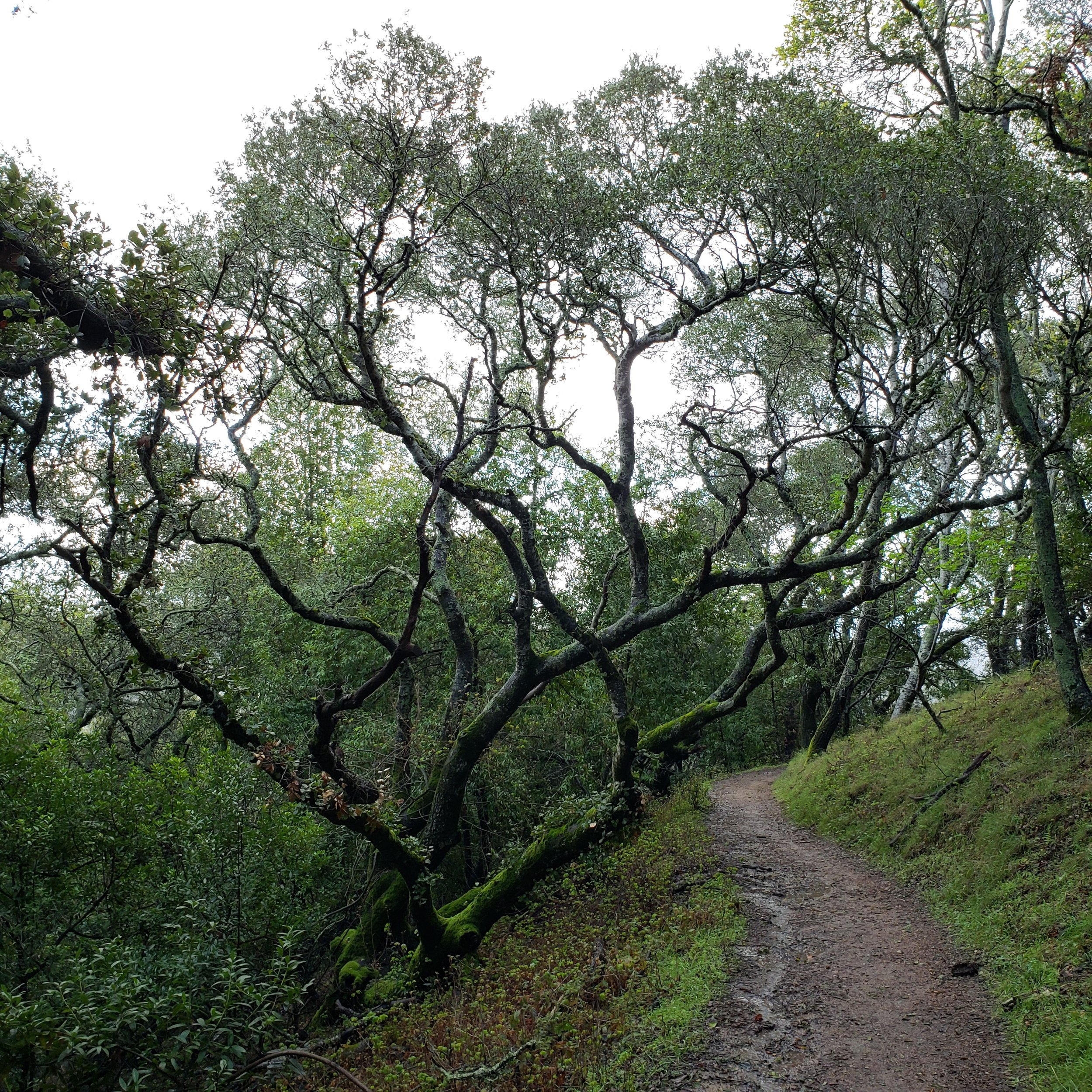
Edgewood Park is similar to the Stanford Dish, but with an additional level of challenge. It is still foothill and former agricultural land, but there are areas of chaparral at higher altitudes. Water is a must on these trails. Wear real walking shoes - the trails are dirt or gravel.
This is a great trail on the first foggy day after a series of dry days - the cooling mist, without the muddy trails.
I enjoy the Sylvan Trail - it is the most gentle of and least switch-back-y of them. Parking for that trailhead is off of Old Stage Coach Road.
There is a secondary entrance on Cañada Road, right before it ducks under the freeway, called the Clarkia Trail. It’s a great morning trail, before it gets too much sun.

The Crystal Springs Regional Trail

This trail runs for 15-17 miles along the reservoirs and the fault. It passes through a fascinating geological zone, containing inclusions of radically tumbled land (layers are vertical, upside down, etc), the green-greasy serpentine rock, and other fault-miracles. These trails are often flat, especially around the reservoirs.
The dam has a plaque honoring the man who architected the project and saw it completed, Hermann Schussler. The inscription reads “IF YOU SEEK HIS MONUMENT, LOOK ABOUT YOU.”
Suggested Trailheads:
Skyline Blvd & Crystal Springs Road. Walk north along the lake edge, or south to the dam. The trail is paved or packed gravel.
Huddart Park

As one of the San Mateo County parks, it has an entrance fee for parking. My favorite trails all start near one location - the Zwierlein Picnic Area. From there, the Crystal Springs trail wends gently around the deep hollows of the hillside, bringing you down to the creek over the course of a half mile. The Dean Trail, and others, will lead you back up.
The redwoods are a moisture-wicking environment, so be sure to bring and drink plenty of water.
Bair Island State Marine Park

Bair Island, the swampy semi-natural wetland area of restored bayshore, near Downtown Redwood City, is a windy, flat, beautiful walk. Bring a bird guide - you will see all sorts of birds, especially if the weather pattern or wind direction changes. The same swamps serve many different polities of poultry, and incubate conspiracies most fowl.
Trail Map pdf.
Extra Resources
Fish & Wildlife Service Bay Area Trail Directory
